
| Run ID | Site Name | NASA Log # | Investigator | Start Lat | Start Lon | Stop Lat | Stop Lon | Start GMT | Stop GMT | Comments |
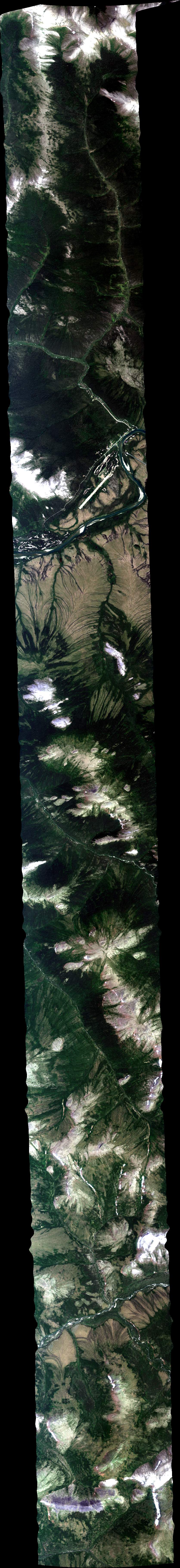
| 003005 | Box (fly listed FL): Nome (NGEE): NGEE_L004_FL188 (orthocorrected) |
19M013a | Charles Miller | 64.92808813 | -163.4848947 | 64.8370038 | -164.2142695 | 0030 | 0036 | Alt = 18 kft SOG = 202 kts Clouds = clear above, haze below MCRS = 62 |
| 003915 | Box (fly listed FL): Nome (NGEE): NGEE_L003_FL188 (orthocorrected) |
19M013a | Charles Miller | 64.81305766 | -164.1980299 | 64.90419365 | -163.4681891 | 0039 | 0045 | Alt = 18 kft SOG = 220 kts Clouds = clear above, haze below MCRS = 242 |
| 004802 | Box (fly listed FL): Nome (NGEE): NGEE_L002_FL188 (orthocorrected) |
19M013a | Charles Miller | 64.8802973 | -163.4515133 | 64.78910976 | -164.1818192 | 0048 | 0054 | Alt = 18 kft SOG = 200 kts Clouds = clear above, haze below MCRS = 62 |
| 005719 | Box (fly listed FL): Nome (NGEE): NGEE_L001_FL188 (orthocorrected) |
19M013a | Charles Miller | 64.76516008 | -164.1656372 | 64.85639909 | -163.4348671 | 0057 | 0103 | Alt = 18 kft SOG = 203 kts Clouds = clear above, haze below MCRS = 214 |
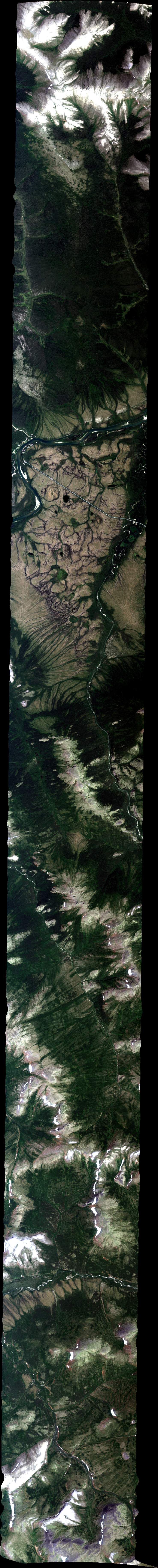
| 010938 | CALM Council grid; Council flux tower: AVng_347A-347Z_FL176 (orthocorrected) |
19M013a | Charles Miller | 64.9006 | -163.8013 | 64.8065 | -163.6628 | 0109 | 0112 | Alt = 18 kft SOG = 216 kts Clouds = clear above, haze below MCRS = 360 |
| 012039 | Kougarok_L003_FL182 (orthocorrected) |
19M013a | Charles Miller | 65.076597 | -164.872555 | 65.490573 | -164.596923 | 0120 | 0128 | Alt = 18 kft SOG = 231 kts Clouds = clear above, more haze below MCRS = 4 |
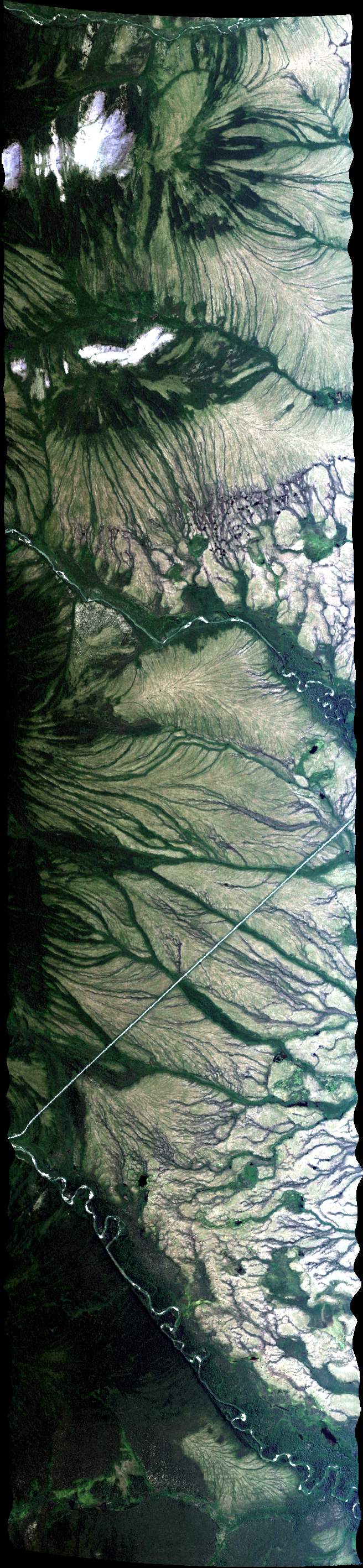
| 013115 | Kougarok_L002_FL182 (orthocorrected) |
19M013a | Charles Miller | 65.497626 | -164.649953 | 65.082131 | -164.933394 | 0131 | 0139 | Alt = 18 kft SOG = 214 kts Clouds = clear above, more haze below MCRS = 185 |
| 014346 | Kougarok_L001_FL182 (orthocorrected) |
19M013a | Charles Miller | 65.029425 | -165.200248 | 65.244279 | -164.634347 | 0143 | 0150 | Alt = 18 kft SOG = 205 kts Clouds = clear above, more haze below MCRS = 36 |
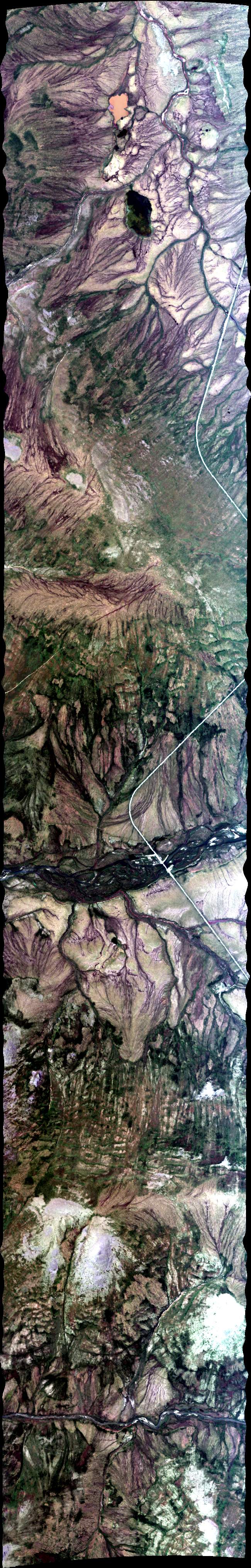
| 015246 | NGEE-Arctic - Teller watershed transect (new Lat2/Lon2 Jul24): AVng_344A-344Z_FL184 (orthocorrected) |
19M013a | Charles Miller | 64.577 | -166.378 | 65.183 | -164.765 | 0152 | 0208 | Alt = 18 kft SOG = 212 kts Clouds = clear above, more haze below MCRS = 218 |
| 021538 | NGEE-Arctic - Teller watershed transect: AVng_343A-343Z_FL179 (orthocorrected) |
19M013a | Charles Miller | 64.7931 | -166.0586 | 64.6545 | -165.8253 | 0215 | 0219 | Alt = 18 kft SOG = 211 kts Clouds = clear above, more haze below MCRS = 133 |
 Back to AVIRIS NG Flight Season page