
| Run ID | Site Name | NASA Log # | Investigator | Start Lat | Start Lon | Stop Lat | Stop Lon | Start GMT | Stop GMT | Comments |
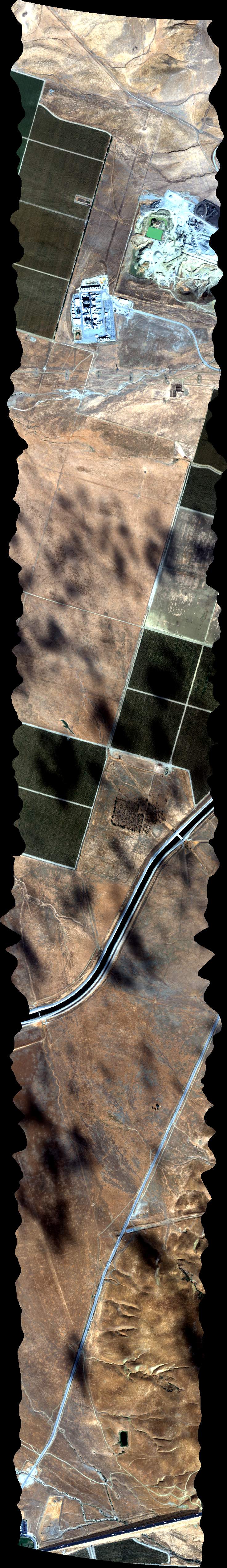
| 180213 | FA17_C09_L001_FL110 (orthocorrected) |
17M040o | Duren | 35.189374 | -119.5835559 | 34.9897868 | -119.3064949 | 1802 | 1809 | Alt = 10.5 kft SOG = 173 kts Clouds = Clear MCRS = 297 |
| 181121 | FA17_C09_L002_FL110 (orthocorrected) |
17M040o | Duren | 35.00019543 | -119.2946213 | 35.19998518 | -119.5719333 | 1811 | 1820 | Alt = 10.5 kft SOG = 141 kts Clouds = Clear MCRS = 116 *Lost nav data |
| 182858 | FA17_C09_L002_FL110 (orthocorrected) |
17M040o | Duren | 35.00019543 | -119.2946213 | 35.19998518 | -119.5719333 | 1828 | 1838 | Alt = 10.5 kft SOG = 128 kts Clouds = Clear MCRS = 116 *Re-fly |
| 183952 | FA17_C09_L003_FL110 (orthocorrected) |
17M040o | Duren | 35.21059526 | -119.5603077 | 35.01060291 | -119.2827447 | 1839 | 1839 | Alt = 10.5 kft SOG = 171 kts Clouds = Clear MCRS = 297 |
| 184915 | FA17_C09_L004_FL110 (orthocorrected) |
17M040o | Duren | 35.02100922 | -119.2708651 | 35.22120423 | -119.548679 | 1849 | 1858 | Alt = 10.5 kft SOG = 135 kts Clouds = Clear MCRS = 116 |
| 190138 | FA17_C08_L001_FL107 (orthocorrected) |
17M040o | Duren | 35.21865982 | -119.5309398 | 35.12795741 | -119.3705076 | 1901 | 1906 | Alt = 10.7 kft SOG = 166 kts Clouds = Clear MCRS = 290 |
| 190807 | FA17_C08_L002_FL107 (orthocorrected) |
17M040o | Duren | 35.13949656 | -119.3602974 | 35.2305346 | -119.5213121 | 1908 | 1913 | Alt = 10.7 kft SOG = 148 kts Clouds = Clear MCRS = 110 |
| 191521 | FA17_C08_L003_FL107 (orthocorrected) |
17M040o | Duren | 35.24240861 | -119.5116816 | 35.15103485 | -119.3500843 | 1915 | 1919 | Alt = 10.7 kft SOG = 167 kts Clouds = Clear MCRS = 290 |
| 192155 | FA17_C08_L004_FL107 (orthocorrected) |
17M040o | Duren | 35.16257229 | -119.3398683 | 35.25428187 | -119.5020483 | 1921 | 1927 | Alt = 10.7 kft SOG = 145 kts Clouds = Clear MCRS = 110 |
| 193741 | FA17_C14_L001_FL112 (orthocorrected) |
17M040p | Duren | 34.94039811 | -118.8709454 | 35.06922534 | -118.7074607 | 1937 | 1942 | Alt = 11.2 kft SOG = 166 kts Clouds = Clear MCRS = 032 |
| 194509 | FA17_C14_L002_FL112 (orthocorrected) |
17M040p | Duren | 35.07618843 | -118.7237205 | 34.94741182 | -118.8871019 | 1945 | 1951 | Alt = 11.2 kft SOG = 134 kts Clouds = Clear MCRS = 212 |
| 195315 | FA17_C14_L003_FL112 (orthocorrected) |
17M040p | Duren | 34.9544234 | -118.9032611 | 35.08314935 | -118.7399831 | 1953 | 1958 | Alt = 11.2 kft SOG = 172 kts Clouds = Clear MCRS = 032 |
| 200015 | FA17_C14_L004_FL112 (orthocorrected) |
17M040p | Duren | 35.0901081 | -118.7562485 | 34.96143283 | -118.9194231 | 2000 | 2006 | Alt = 11.2 kft SOG = 144 kts Clouds = Clear MCRS = 212 |
| 200752 | FA17_C14_L005_FL112 (orthocorrected) |
17M040p | Duren | 34.96844012 | -118.9355879 | 35.09706467 | -118.7725167 | 2007 | 2012 | Alt = 11.2 kft SOG = 167 kts Clouds = Clear MCRS = 032 |
| 201511 | FA17_C14_L006_FL112 (orthocorrected) |
17M040p | Duren | 35.10401907 | -118.7887876 | 34.97544527 | -118.9517554 | 2015 | 2020 | Alt = 11.2 kft SOG = 142 kts Clouds = Clear MCRS = 212 |
| 202243 | FA17_C14_L007_FL112 (orthocorrected) |
17M040p | Duren | 34.98244828 | -118.9679257 | 35.1109713 | -118.8050613 | 2022 | 2027 | Alt = 11.2 kft SOG = 173 kts Clouds = Clear MCRS = 032 |
| 203712 | FA17_C12_L007_FL104 (orthocorrected) |
17M040o | Duren | 35.45085392 | -119.1015576 | 35.32312862 | -118.9612718 | 2037 | 2042 | Alt = 10.4 kft SOG = 134 kts Clouds = Clear MCRS = 123 |
| 204942 | FA17_C12_L007_FL104 (orthocorrected) |
17M040o | Duren | 35.45085392 | -119.1015576 | 35.32312862 | -118.9612718 | 2049 | 2055 | Alt = 10.4 kft SOG = 130 kts Clouds = Clear MCRS = 123 |
| 210217 | FA17_CA_Compress_L_013_FL077 (orthocorrected) |
17M040s | Duren | 35.282832 | -119.513394 | 35.267396 | -119.360225 | 2102 | 2106 | Alt = 7.7 kft SOG = 154 kts Clouds = Clear MCRS = 262 |
| 211517 | FA17_CA_Compress_L_014_FL070 (orthocorrected) |
17M040s | Duren | 35.060873 | -119.119853 | 35.06085 | -118.965966 | 2115 | 2119 | Alt = 7.0 kft SOG = 150 kts Clouds = Clear MCRS = 075 |
| 212345 | FA17_CA_Compress_L_023_FL072 (orthocorrected) |
17M040s | Duren | 35.052992 | -118.9001 | 35.05308 | -118.810624 | 2123 | 2126 | Alt = 7.2 kft SOG = 139 kts Clouds = Clear MCRS = 076 |
| 212911 | FA17_CA_Compress_L_024_FL072 (orthocorrected) |
17M040s | Duren | 35.174062 | -118.848789 | 35.149028 | -118.764579 | 2129 | 2132 | Alt = 7.2 kft SOG = 161 kts Clouds = Clear MCRS = 275 |
| 214313 | FA17_CA_Compress_L_029_FL068 (orthocorrected) |
17M040s | Duren | 35.40486 | -119.292535 | 35.364973 | -119.217175 | 2143 | 2146 | Alt = 6.8 kft SOG = 142 kts Clouds = Clear MCRS = 108 |
| 214946 | FA17_CA_Compress_L_028_FL068 (orthocorrected) |
17M040s | Duren | 35.284504 | -119.231814 | 35.298522 | -119.143763 | 2149 | 2152 | Alt = 6.8 kft SOG = 147 kts Clouds = Clear MCRS = 169 |
| 220326 | FA17_CA_Compress_L_027_FL068 (orthocorrected) |
17M040s | Duren | 35.301201 | -119.345829 | 35.259229 | -119.272167 | 2203 | 2206 | Alt = 6.8 kft SOG = 143 kts Clouds = Clear MCRS = 110 |
| 221029 | FA17_CA_Compress_L_026_FL068 (orthocorrected) |
17M040s | Duren | 35.168009 | -119.356271 | 35.126107 | -119.282861 | 2210 | 2213 | Alt = 6.8 kft SOG = 145 kts Clouds = Clear MCRS = 110 |
| 221608 | FA17_CA_Compress_L_025_FL073 (orthocorrected) |
17M040s | Duren | 35.05519 | -119.10763 | 35.003406 | -119.043929 | 2216 | 2219 | Alt = 7.3 kft SOG = 147 kts Clouds = Clear MCRS = 120 |
| 222113 | FA17_CA_Compress_L_022_FL077 (orthocorrected) |
17M040s | Duren | 34.937899 | -118.917667 | 34.958017 | -118.831715 | 2221 | 2224 | Alt = 7.7 kft SOG = 148 kts MCRS = 059 |
| 222755 | FA17_CA_Compress_L_030_FL104 (orthocorrected) |
17M040s | Duren | 34.809919 | -118.802872 | 34.743432 | -118.765375 | 2227 | 2230 | Alt = 10.4 kft SOG = 133 kts MCRS = 141 *Nav data loss throughout line |
| 223113 | FA17_CA_Compress_L_031_FL098 (quicklook in process) | 17M040s | Duren | 34.691831 | -118.740697 | 34.606098 | -118.696257 | 2231 | 2234 | Alt = 10.4 kft *Nav data loss throughout line |
| 223923 | FA17_CA_Compress_L_015_FL077 (orthocorrected) |
17M040s | Duren | 34.469905 | -118.573941 | 34.42461 | -118.599653 | 2239 | 2241 | Alt = 5.0 kft SOG = 131 kts Clouds = Clear MCRS = 191 |
| 224512 | FA17_AC1_L003_FL038 (orthocorrected) |
17M040r | Duren | 34.32006233 | -118.6033258 | 34.32002453 | -118.5240218 | 2245 | 2248 | Alt = 5.0 kft SOG = 147 kts Clouds = Clear MCRS = 076 |
| 225229 | FA17_AC1_L004_FL038 (orthocorrected) |
17M040r | Duren | 34.32236047 | -118.5239621 | 34.32239829 | -118.6031814 | 2252 | 2255 | Alt = 5.0 kft SOG = 140 kts Clouds = Clear MCRS = 256 |
 Back to AVIRIS NG Flight Season page