
| Run ID | Site Name | NASA Log # | Start_Lat | Start Lat | Start Lon | Stop Lat | Stop Lon | Start GMT | Stop GMT | Comments |
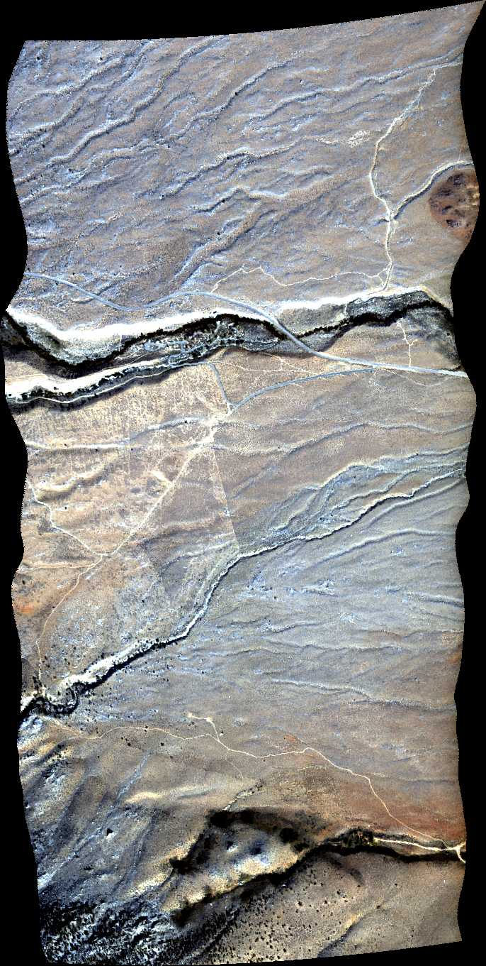
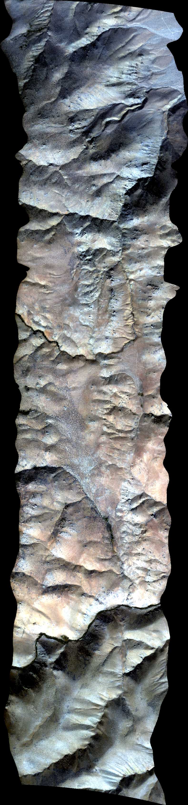
| 182757 | Lone Pine, CA (orthocorrected) |
14T012 | Nancy Glenn | 36.5822 | -118.183 | 36.6042 | -118.183 | 1827 | 1830 | Alt = 15 kft Clouds = Clear MCRS = S to N |
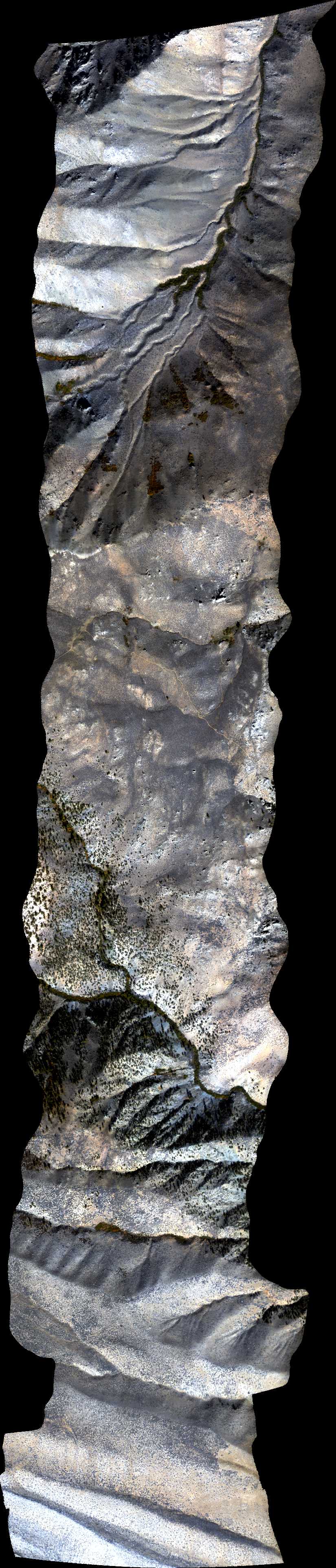
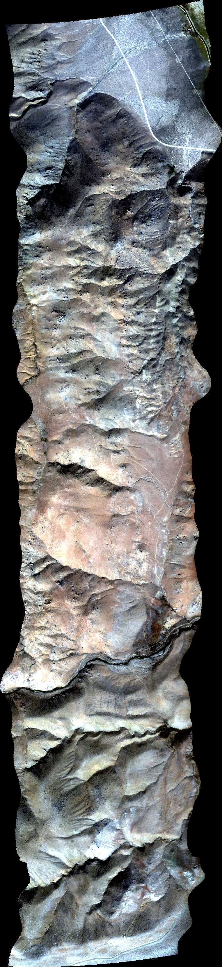
| 184333 | Big Pine 2m 1, CA (orthocorrected) |
14T012 | Nancy Glenn | 37.2025 | -118.3976 | 37.1345 | -118.3976 | 1843 | 1847 | Alt = 14.5 kft SOG = 85 kts Clouds = Clear MCRS = 347 |
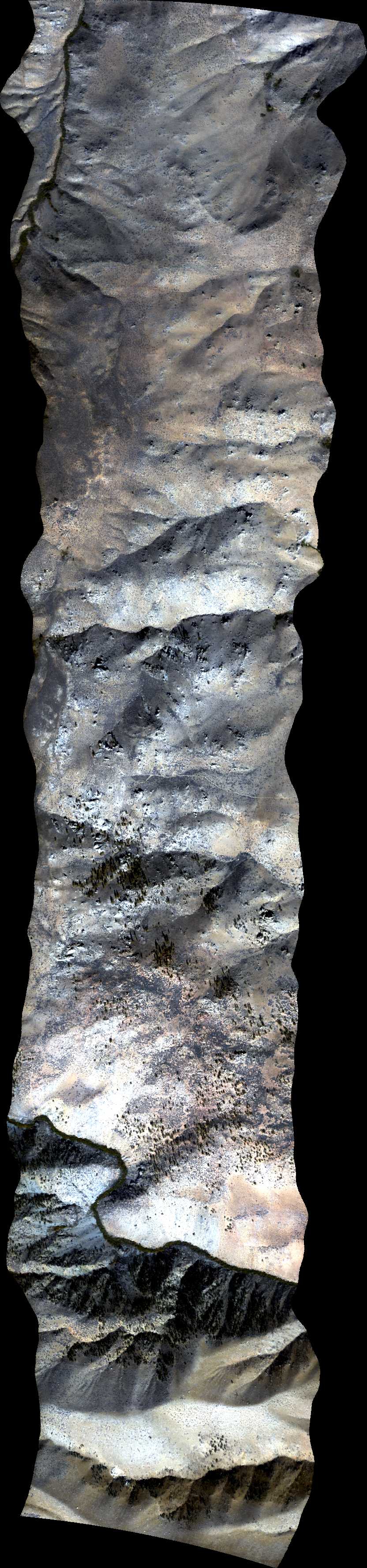
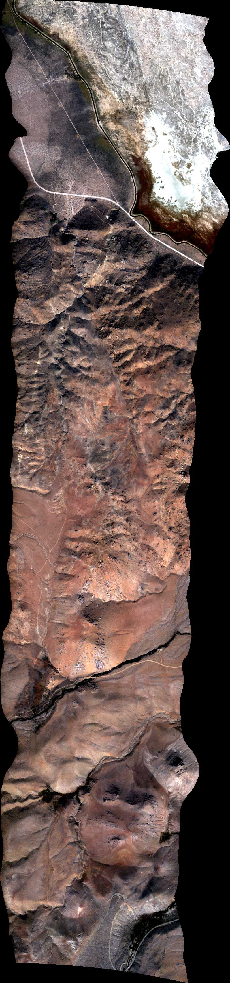
| 184932 | Big Pine 2m 2, CA (orthocorrected) |
14T012 | Nancy Glenn | 37.2025 | -118.3857 | 37.1345 | -118.3857 | 1849 | 1853 | Alt = 14.5 kft SOG = 97 kts Clouds = Clear MCRS = 167 |
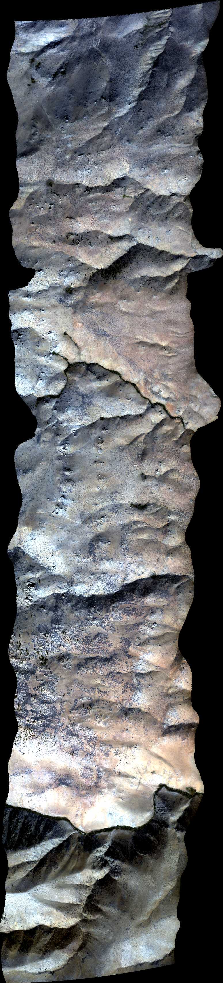
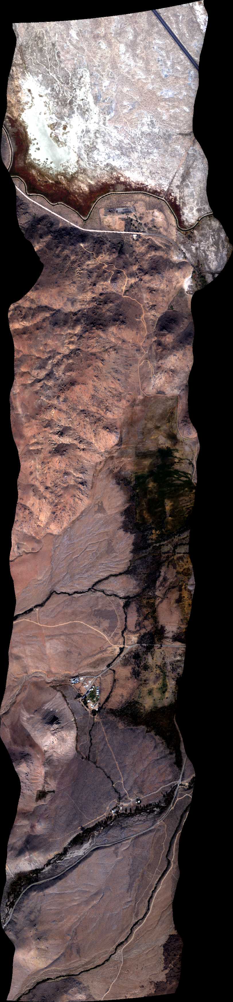
| 185507 | Big Pine 2m 3, CA (orthocorrected) |
14T012 | Nancy Glenn | 37.2025 | -118.3738 | 37.1345 | -118.3738 | 1855 | 1858 | Alt = 14 kft SOG = 91 kts Clouds = Clear MCRS = 347 |
| 190025 | Big Pine 2m 4, CA (orthocorrected) |
14T012 | Nancy Glenn | 37.2025 | -118.3619 | 37.1345 | -118.3619 | 1900 | 1904 | Alt = 14 kft SOG = 90 kts Clouds = Clear MCRS = 167 |
| 190613 | Big Pine 2m 5, CA (orthocorrected) |
14T012 | Nancy Glenn | 37.2025 | -118.3500 | 37.1345 | -118.3500 | 1906 | 1909 | Alt = 13.5 kft SOG = 90 kts Clouds = Clear MCRS = 347 |
| 191137 | Big Pine 2m 6, CA (orthocorrected) |
14T012 | Nancy Glenn | 37.2025 | -118.3382 | 37.1345 | -118.3382 | 1911 | 1915 | Alt = 13 kft SOG = 87 kts Clouds = Clear MCRS = 167 |
| 191655 | Big Pine 2m 7, CA (orthocorrected) |
14T012 | Nancy Glenn | 37.2025 | -118.3263 | 37.1345 | -118.3264 | 1917 | 1920 | Alt = 12.5 kft SOG = 98 kts Clouds = Clear MCRS = 347 |
| 192232 | Big Pine 2m 8, CA (orthocorrected) |
14T012 | Nancy Glenn | 37.2025 | -118.3144 | 37.1345 | -118.3144 | 1922 | 1926 | Alt = 12 kft SOG = 87 kts Clouds = Clear MCRS = 167 |
| 194421 | NEON Relocatable Site 1, CA (orthocorrected) |
14T011 | Phil Townsend | 36.964925 | -118.97845 | 37.05230556 | -119.2867111 | 1944 | 1955 | Alt = 17.5 kft SOG = 102 kts Clouds = Clear MCRS = 276 |
| 195634 | NEON Relocatable Site 2, CA (orthocorrected) |
14T011 | Phil Townsend | 36.95214167 | -118.9896611 | 37.03866389 | -119.2918222 | 1956 | 2006 | Alt = 17.5 kft SOG = 93 kts Clouds = Clear MCRS = 096 |
| 200832 | NEON Relocatable Site 3, CA (orthocorrected) |
14T011 | Phil Townsend | 36.93666111 | -118.9971028 | 37.02322222 | -119.2985806 | 2008 | 2019 | Alt = 17.5 kft SOG = 94 kts Clouds = Clear MCRS = 277 |
| 202432 | Shaver Lake, CA (orthocorrected) |
14T011 | Phil Townsend | 37.17945 | -119.3038333 | 36.88988889 | -119.3038333 | 2024 | 2036 | Alt = 17.5 kft SOG = 100 kts Clouds = Clear MCRS = 347 |
| 204038 | Mixed Confier Site 1, CA (orthocorrected) |
14T011 | Phil Townsend | 37.089137 | -119.216320 | 37.025656 | -119.176128 | 2040 | 2043 | Alt = 17.5 kft SOG = 107 kts Clouds = Clear MCRS = 140 |
| 204547 | Mixed Confier Site 2, CA (orthocorrected) |
14T011 | Phil Townsend | 37.09725 | -119.19619 | 37.03377 | -119.15602 | 2045 | 2049 | Alt = 17.5 kft SOG = 95 kts Clouds = Clear MCRS = 320 |
| 205125 | Mixed Confier Site 3, CA (orthocorrected) |
14T011 | Phil Townsend | 37.08102 | -119.23644 | 37.01754 | -119.19624 | 2051 | 2054 | Alt = 17.5 kft SOG = 105 kts Clouds = Clear MCRS = 140 |
| 212559 | Kern Oildale Methane (orthocorrected) |
Leifer | 2126 | 2137 | Alt = 11.5 kft SOG = 98 kts Clouds = Clear MCRS = 160 |
 Back to AVIRIS NG Flight Season page