
| Run ID | Site Name | NASA Log # | Start_Lat | Start Lat | Start Lon | Stop Lat | Stop Lon | Start GMT | Stop GMT | Comments |
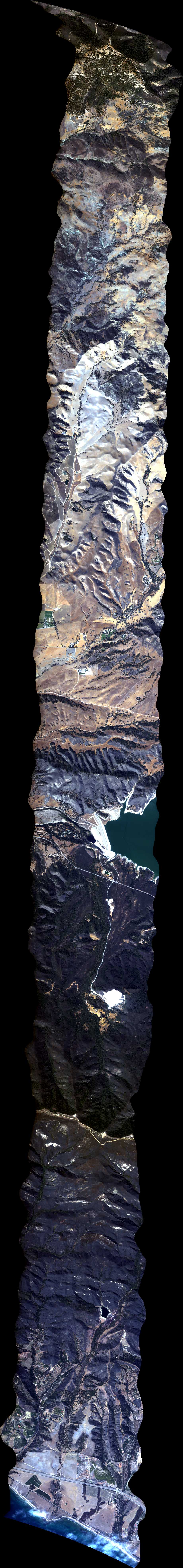
| 185340 | Santa Barbara 11, CA (orthocorrected) |
14T011 | Phil Townsend | 34.42383 | -119.6008 | 34.42383 | -119.939921 | 1853 | 1907 | Alt = 16.8 kft SOG = 90 kts Clouds = Clear Direction = 167.2 deg |
| 191115 | Santa Barbara 4, CA (orthocorrected) |
14T011 | Phil Townsend | 34.74778 | -120.0512 | 34.45 | -120.0512016 | 1911 | 1922 | Alt = 16.8 kft SOG = 95 kts Clouds = Clear Direction = 347.3 deg |
| 192447 | Santa Barbara 5, CA (orthocorrected) |
14T011 | Phil Townsend | 34.45 | -120.0340263 | 34.74778 | -120.034 | 1924 | 1938 | Alt = 16.8 kft SOG = 90 kts Clouds = Clear Direction = 167.2 deg |
| 194016 | Santa Barbara 6, CA (orthocorrected) |
14T011 | Phil Townsend | 34.74778 | -120.0169 | 34.45 | -120.0168511 | 1940 | 1952 | Alt = 16.9 kft SOG = 100 kts Clouds = Clear Direction = 347.3 deg |
| 195417 | Santa Barbara 7, CA (orthocorrected) |
14T011 | Phil Townsend | 34.45 | -119.9996758 | 34.74778 | -119.9997 | 1954 | 2007 | Alt = 16.8 kft SOG = 80 kts Clouds = Clear Direction = 167.2 deg |
| 200859 | Santa Barbara 8, CA (orthocorrected) |
14T011 | Phil Townsend | 34.74778 | -119.9825 | 34.45 | -119.9825005 | 2008 | 2020 | Alt = 16.9 kft SOG = 100 kts Clouds = Clear above, coastal fog below Direction = 347.3 deg |
| 202237 | Santa Barbara 9, CA (orthocorrected) |
14T011 | Phil Townsend | 34.38958 | -119.635 | 34.38958 | -119.974167 | 2022 | 2036 | Alt = 16.9 kft SOG = 80 kts Clouds = Clear Direction = 347.3 deg |
| 203801 | Santa Barbara 10, CA (orthocorrected) |
14T011 | Phil Townsend | 34.40671 | -119.957044 | 34.40671 | -119.6179 | 2038 | 2151 | Alt = 16.9 kft SOG = 100 kts Clouds = Clear Direction = 347.3 deg Run has a turn in it |
| 205157 | Santa Barbara 11, CA (orthocorrected) |
14T011 | Phil Townsend | 34.42383 | -119.6008 | 34.42383 | -119.939921 | 2051 | 2105 | Alt = 16.9 kft SOG = 86 kts Clouds = Clear Direction = 167.3 deg |
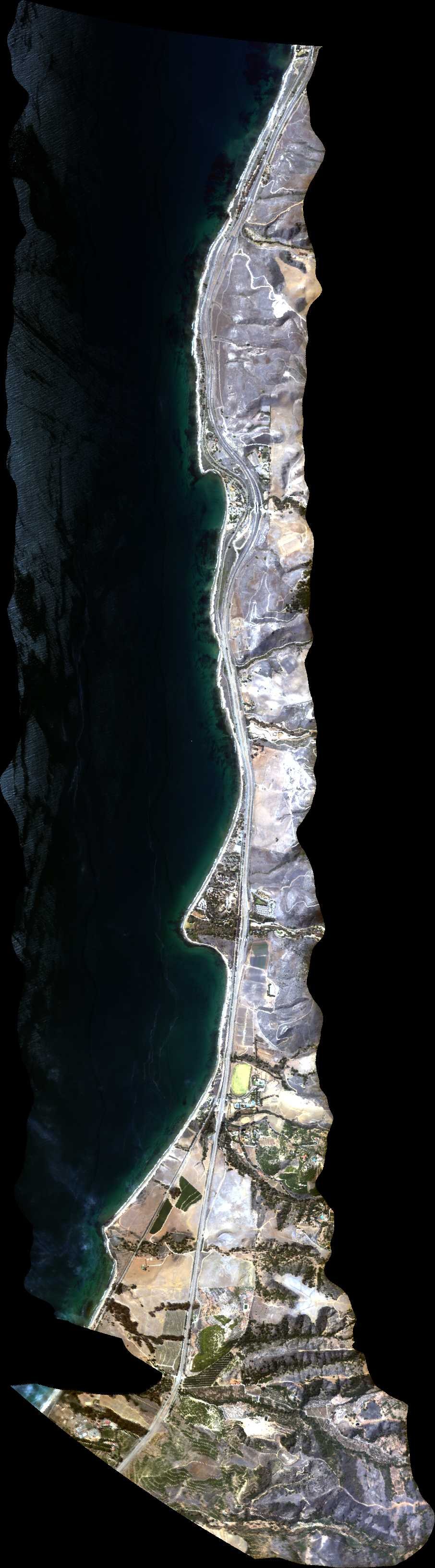
| 210837 | Santa Barbara Ad Hoc line along coast (orthocorrected) |
Dar Roberts | 2108 | 2105 | Alt = 16.5 kft SOG = 80 kts Clouds = Clear Direction = 252 deg |
|||||
| 212311 | Oil platforms off Santa Barbara (orthocorrected) |
Green | 2123 | 2127 | Alt = 9.5 kft SOG = 80 kts Clouds = Clear Direction = 84 deg |
 Back to AVIRIS NG Flight Season page