
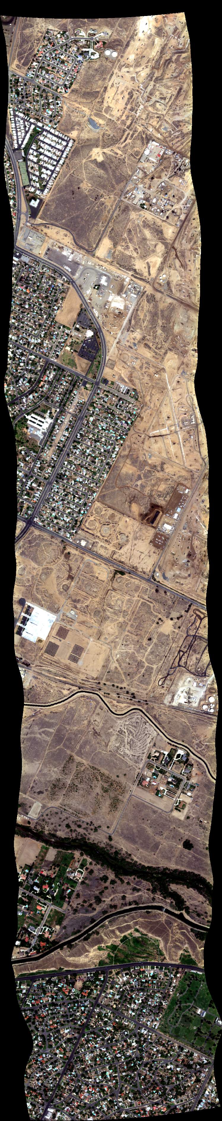
| Run ID | Site Name | NASA Log # | Start_Lat | Start Lat | Start Lon | Stop Lat | Stop Lon | Start GMT | Stop GMT | Comments |
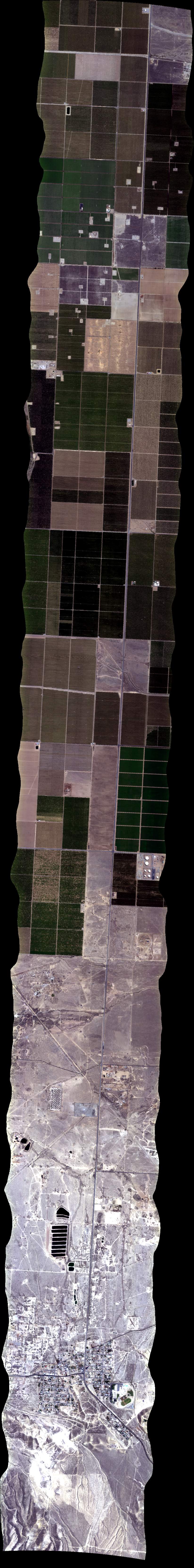
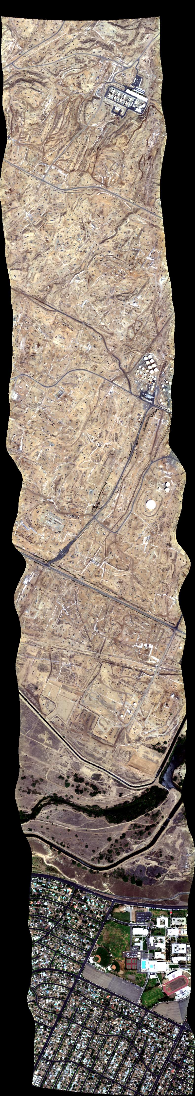
| 180901 | Kern T3, CA (orthocorrected) |
14T015 | Leifer | 35.058340 | -119.428235 | 35.062707 | -119.177964 | 1809 | 1821 | Alt = 12.5 kft SOG = 62 kts Clouds = clear, light haze down low Direction = 256 deg |
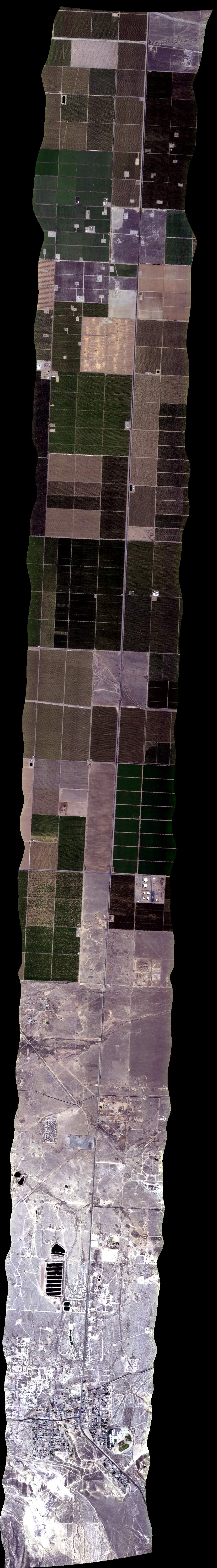
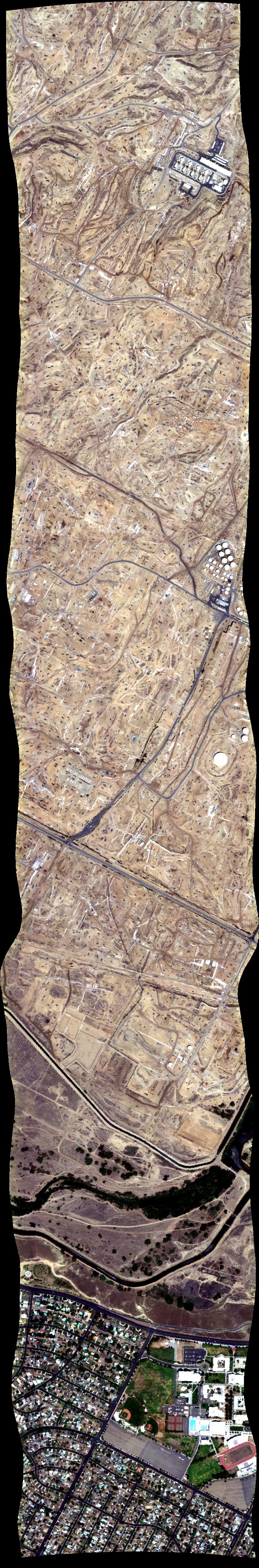
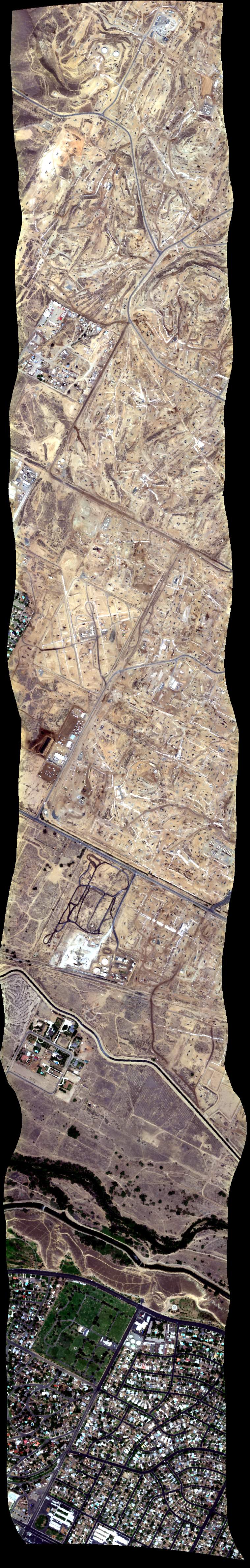
| 182419 | Kern T3, CA (orthocorrected) |
14T015 | Leifer | 35.058340 | -119.428235 | 35.062707 | -119.177964 | 1824 | 1832 | Alt = 12.5 kft SOG = 97 kts Clouds = clear, light haze down low Direction = 76 deg |
| 184259 | Kern Plume 7, CA (orthocorrected) |
14T015 | Leifer | 35.451702 | -119.022548 | 35.399526 | -118.989263 | 1843 | 1846 | Alt = 6.5 kft SOG = 75 kts Clouds = clear, light haze down low Direction = 320 deg |
| 184958 | Kern Plume 8, CA (orthocorrected) |
14T015 | Leifer | 35.401947 | -118.981684 | 35.453410 | -119.014783 | 1850 | 1853 | Alt = 6.5 kft SOG = 80 - 82 kts Clouds = clear, light haze down low Direction = 139 deg |
| 185536 | Kern Plume 9, CA (orthocorrected) |
14T015 | Leifer | 35.456470 | -119.007195 | 35.404826 | -118.973817 | 1856 | 1900 | Alt = 6.5 kft SOG = 66 kts Clouds = clear, light haze down low Direction = 319 deg |
| 190114 | Kern Plume 7, CA (orthocorrected) |
14T015 | Leifer | 35.451702 | -119.022548 | 35.399526 | -118.989263 | 1901 | 1904 | Alt = 6.5 kft SOG = 83 kts Clouds = clear, light haze down low Direction = 148 deg |
| 190648 | Kern Plume 8, CA (orthocorrected) |
14T015 | Leifer | 35.401947 | -118.981684 | 35.453410 | -119.014783 | 1907 | Alt = 6.5 kft SOG = 68 kts Clouds = clear, light haze down low Direction = 320 deg |
|
| 191318 | Kern Plume 9, CA (orthocorrected) |
14T015 | Leifer | 35.456470 | -119.007195 | 35.404826 | -118.973817 | 1913 | 1916 | Alt = 6.5 kft SOG = 82 kts Clouds = clear, light haze down low Direction = 139 deg |
| 191952 | Kern Plume 7, CA (orthocorrected) |
14T015 | Leifer | 35.451702 | -119.022548 | 35.399526 | -118.989263 | 1920 | 1923 | Alt = 6.5 kft SOG = 74 kts Clouds = clear, light haze down low Direction = 320 deg GPS red, backup |
| 192558 | Kern Plume 8, CA (orthocorrected) |
14T015 | Leifer | 35.401947 | -118.981684 | 35.453410 | -119.014783 | 1926 | 1929 | Alt = 6.5 kft SOG = 80 kts Clouds = clear, light haze down low Direction = 139 deg |
| 193306 | Kern Plume 9, CA (orthocorrected) |
14T015 | Leifer | 35.456470 | -119.007195 | 35.404826 | -118.973817 | 1933 | 1936 | Alt = 6.5 kft SOG = 68 kts Clouds = clear, light haze down low Direction = 319 deg |
| 193930 | Kern/COMEX Improvised (orthocorrected) |
14T015 | Leifer | 1939 | 1942 | Alt = 6.5 kft SOG = 91 - 77 kts Clouds = clear, light haze down low Direction = 229 deg NE-SW to SW of box |
||||
| 194516 | Kern/COMEX Improvised (orthocorrected) |
14T015 | Leifer | 1945 | 1951 | Alt = 6.5 kft SOG = 77 kts Clouds = clear, light haze down low Direction = 47 deg SW of box |
||||
| 195319 | Kern/COMEX Improvised (orthocorrected) |
14T015 | Leifer | 1953 | 1959 | Alt = 6.5 kft SOG = 75 kts Clouds = clear, light haze down low Direction = 265 deg SW of box |
||||
| 200718 | Kern 1, CA (orthocorrected) |
14T015 | Leifer | 35.478416 | -119.109687 | 35.382723 | -118.967921 | 2007 | 2015 | Alt = 10 kft SOG = 74 kts Clouds = clear, light haze down low Direction = 299 deg |
| 201854 | Kern 2, CA (orthocorrected) |
14T015 | Leifer | 35.389871 | -118.959857 | 35.508300 | -119.128290 | 2019 | 2020 | Alt = 10 kft SOG = 89 - 100 kts Clouds = clear, light haze down low Direction = 118 deg |
| 202915 | Kern 3, CA (orthocorrected) |
14T015 | Leifer | 35.522202 | -119.115925 | 35.401998 | -118.947275 | 2029 | 2036 | Alt = 10 kft SOG = 100 kts Clouds = clear, light haze down low Direction = 298 deg hiccup but no red |
| 203842 | Kern 4, CA (orthocorrected) |
14T015 | Leifer | 35.410979 | -118.938336 | 35.532256 | -119.105656 | 2039 | 2046 | Alt = 10 kft SOG = 96 kts Clouds = clear, light haze down low Direction = 119 deg |
| 204805 | Kern 5, CA (orthocorrected) |
14T015 | Leifer | 35.545206 | -119.093859 | 35.422178 | -118.926907 | 2048 | 2055 | Alt = 10 kft SOG = 102 kts Clouds = clear, light haze down low Direction = 299 deg |
| 205819 | Kern 6, CA (orthocorrected) |
14T015 | Leifer | 35.563781 | -119.100945 | 35.422545 | -118.901937 | 2058 | 2106 | Alt = 10 kft SOG = 104 kts Clouds = clear, light haze down low Direction = 118 deg CIRPAS |
| 211612 | Kern Target of Opportunity (orthocorrected) |
Leifer | 2116 | 2120 | Alt = 10 kft SOG = 94 kts Clouds = clear, light haze down low Direction = 217 deg |
|||||
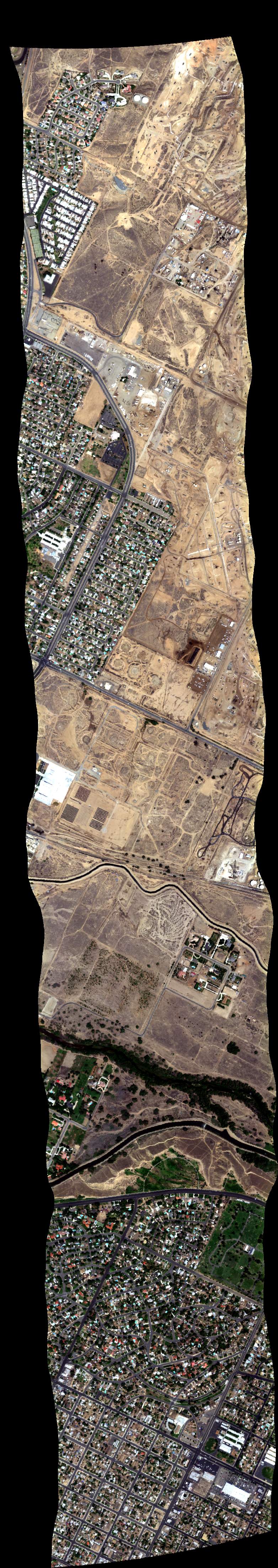
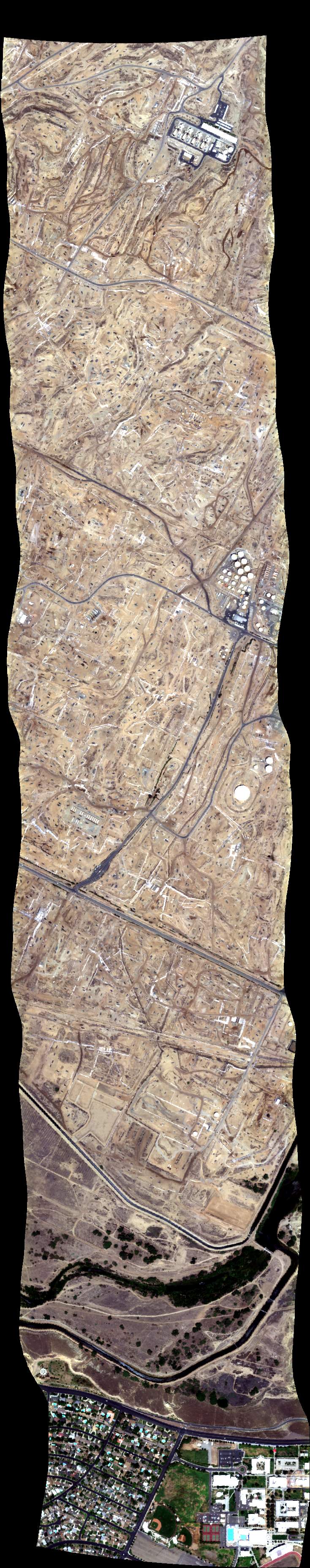
| 212716 | Kern T1, CA (orthocorrected) |
14T015 | Leifer | 35.472868° | -119.282722° | 35.483376 | -119.472119 | 2127 | 2132 | Alt = 12.5 kft SOG = 115 kts Clouds = clear, light haze down low Direction = 261 deg |
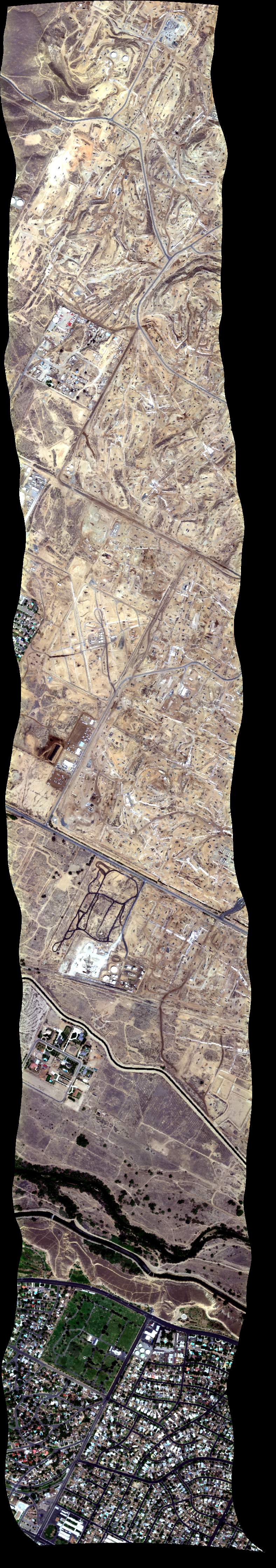
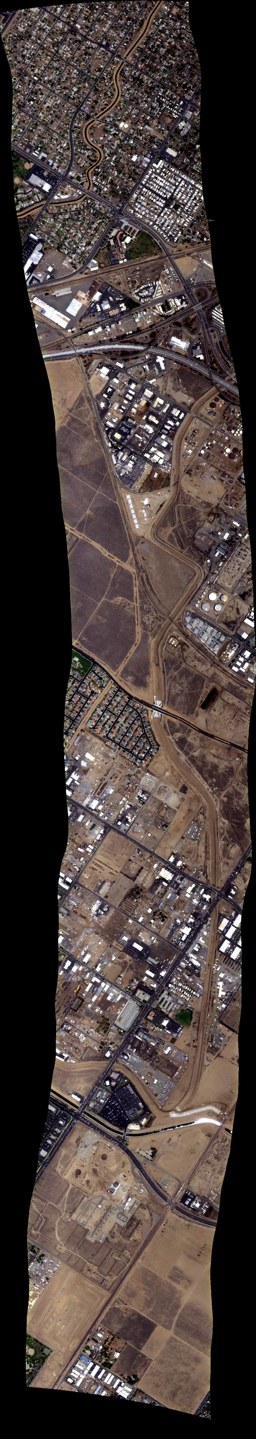
| 214133 | Kern T2, CA (orthocorrected) |
14T015 | Leifer | 35.573866 | -119.803300 | 35.121027 | -119.495411 | 2142 | 2157 | Alt = 12.5 kft SOG = 120 kts Clouds = clear, light haze down low Direction = 138 deg |
| 220805 | Soda Dry Lake (orthocorrected) |
14T018 | Robert Green | 35.218271 | -119.887513 | 35.259780 | -119.903207 | 2208 | 2214 | Alt = 4 kft SOG = 117 kts Clouds = clear Direction = 331 deg |
 Back to AVIRIS NG Flight Season page